Grise Fiord, located on Ellesmere Island in Nunavut, is the northernmost community in Canada’s Arctic and home to approximately 130 people. Over the last 20 years, community members have noticed significant changes to their coastline and increasing numbers of storm impacts. To better understand these changes and how they may need to adapt, they are collaborating with Dr. David Didier, a coastal morphologist currently working at the University of Quebec at Rimouski (UQAR).
Didier’s research focuses on the impacts of waves and water level on coastlines. Much of his work is in the Canadian Arctic, where coastal hazards significantly affect communities. With the help of students and post-doctoral fellows, he helps these northern communities better anticipate potential hazards and aims to understand the impacts of increasing storm frequency along coastlines, reduced ice cover, and changing sediment input from glaciers.
The project in Grise Fiord aims to identify where the hotspots of coastline change are, focusing on the entire area between Devon Island and Ellesmere Island. The project, which started two years ago, involves hazard mapping, including flood and erosion mapping, while also integrating local knowledge into scientific monitoring and modeling. At the core of the project is extensive information about past hazard events and extreme storms shared with the team from the collective memory of the community. Within the last decade alone, there have been at least 3-4 major storms with waves exceeding the height of people walking on the beach, causing damage along the coastline and to the community’s infrastructure.
“During storms there,” Didier comments, “the electrical networks and the power lines can be under water.” The beach has recently become very narrow and steep, and it is now made up of much larger grain sizes. These changes to the beach structure are making it hard for the community to access the beach; in particular, it is making it more difficult to launch and retrieve the boats and subsequently limits their access to food sources.
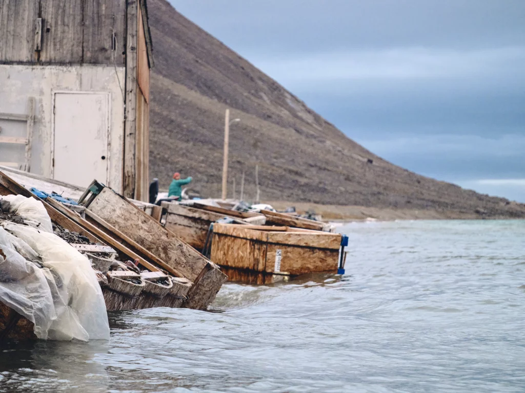
Figure 1: Grise Fiord coastline (photo credit: Dr. David Didier)
Despite these significant changes noted by community members, the Canadian High Arctic generally is not considered a region of high coastal change. In fact, the coastline here is supposed to be emerging faster than the global sea level rise, meaning that theoretically the sea level is falling. However, Didier believes that changing wave conditions are likely part of the problem. He notes that extreme events with the most significant damage often occur when both critical water level and critical wave height are exceeded, leading to severe impacts to the coastline and community, especially when sea ice extents are reduced in summer.
Although the collective knowledge of the community is the invaluable foundation of this project, developing efficient adaptation strategies to rapid coastal changes associated with climate change is complicated. Didier has therefore implemented a multi-faceted and comprehensive monitoring plan. Twelve long-lasting RBRvirtuoso3 D sensors are deployed in the water column, creating a grid of observations in the coastal zone to effectively encompass the unique and complex geomorphology of the region, including the alongshore and cross-shore areas and a shallow rocky platform. The goal is to find a statistical correlation between the sensors to better understand wave propagation and to determine the wave energy reaching the beach. The sensors are deployed for the entire open water season and are continuously monitoring with 4Hz resolution. They are coupled with three video stations, also monitoring with 4Hz resolution at the sensor locations, mountain-based time-lapse cameras, and drone surveys. All of these tools are synchronized together to understand the fundamental morphodynamics of Grise Fiord’s beach. All data are visualized locally in RBR Ruskin software, and further processed in Matlab to determine incident offshore/nearshore wave energy and wave runup on the beach face.
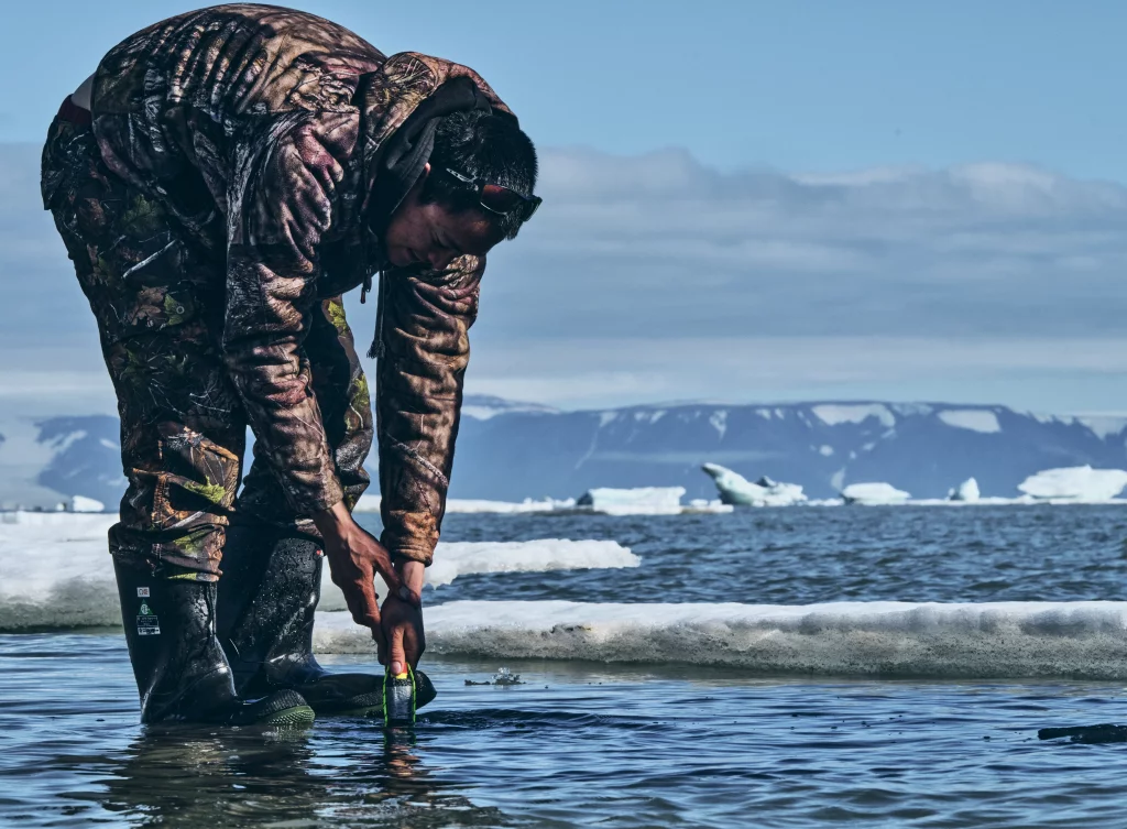
Figure 2: Participatory community involvement (photo credit: Dr. David Didier)
The community is heavily involved with all levels of this monitoring plan, with all instrument locations validated by the Iviq Hunters and Trappers Organization to ensure the scientists are capturing the hotspots of shoreline changes without compromising the hunting area. Didier and Terry Noah, his main point of contact in the community, are in almost non-stop communication about the project. The maintenance, including battery changes and data download, of the sensors are collaboratively performed by local partners, students, and scientists. Land-based observations from community members who are using the shoreline every day are also integrated into the monitoring.
So far, the team has completed one sampling season. As such, Didier is waiting to have more data from the second season, which is currently underway, to publish preliminary results of the timeseries they are collecting.
Overall, the sampling strategy has a two-fold purpose: (1) provide long-term scientific monitoring of the coastline; and (2) provide observations to help validate and calibrate a regional morphodynamic model. Currently, the researchers are performing forecast wave model simulations and validation to look at actual storm events during the monitoring period. They will be using this model to reproduce past energetic events along the coastline (hindcast) and are comparing the results to local knowledge to validate the model. Once the hindcast model is validated and its uncertainty and biases are better understood, the team will develop a predictive model of coastal water levels.
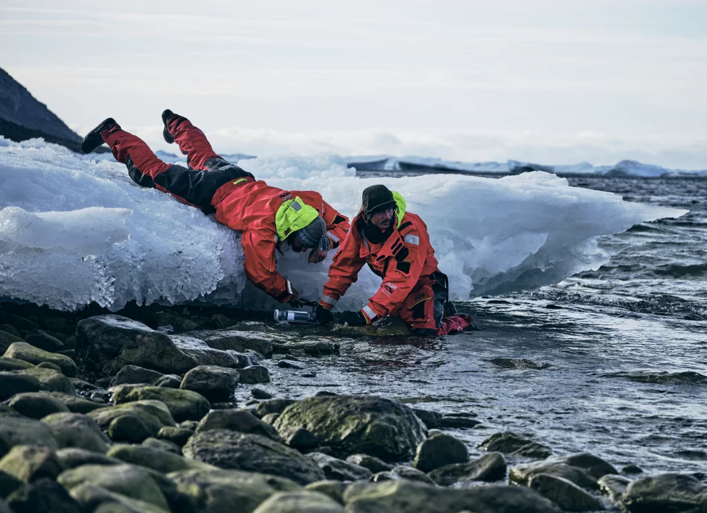
Figure 3: Researchers in Grise Fiord (photo credit: Dr. David Didier)
“We expect to have a three-day forecast of total water level on the beach including wave runup at the shoreline, so the community can prepare in advance for upcoming storms and impacts along the coastline,” Didier explains. Based on the community’s needs, he believes that this model will be one of the most exciting outcomes of the project.
Going forward, Didier and his team will expand this morphodynamic project to look at larger scale changes to the beach system in the context of a changing Arctic system. This upcoming work will focus on the linkages between glaciers and ocean, specifically the sediment transport in the rivers coming from different glaciers towards the coastline. Didier believes that looking at the fate of sediments once they reach the coast will be key to understanding the mechanisms behind the changes occurring in Grise Fiord.
Story by Krysten Rutherford