
Lake St Clair, nestled in Tasmania’s central highlands within the world-heritage-listed Cradle Mountain–Lake St Clair National Park, has long captivated visitors as a pristine wilderness lake sculpted by ancient glaciers. Yet until recently, an unexpectedly fundamental question remained unanswered: just how deep is it?
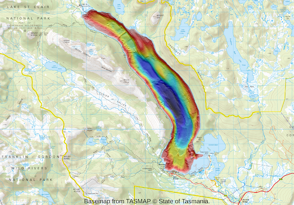
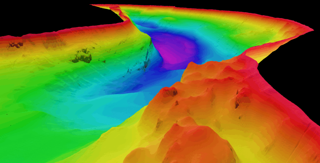
That mystery was finally resolved in November 2025 when CSIRO, Australia’s national science agency, published the first high-resolution, 3D hydrographic map of the lakebed — confirming a maximum depth of 163 metres and cementing Lake St Clair’s status as Australia’s deepest lake. It not only surpasses all other Australian lakes, all of which are under 100m deep, but it is deeper than Bass Strait, the 250km wide channel dividing Tasmania from mainland Australia. The full project story can be explored via CSIRO’s announcement
Depth, however, is only part of the lake’s wider hydrological picture. For researchers, recreational users, and water-resource managers, understanding how the water level changes over time is essential to protecting the lake’s ecology, ensuring safe access, and monitoring broader environmental trends. While Lake St Clair is a freshwater system more than 700 metres above sea level — and therefore unaffected by ocean tides — its water level still shifts in response to rainfall, catchment inflows, runoff, and evaporation.
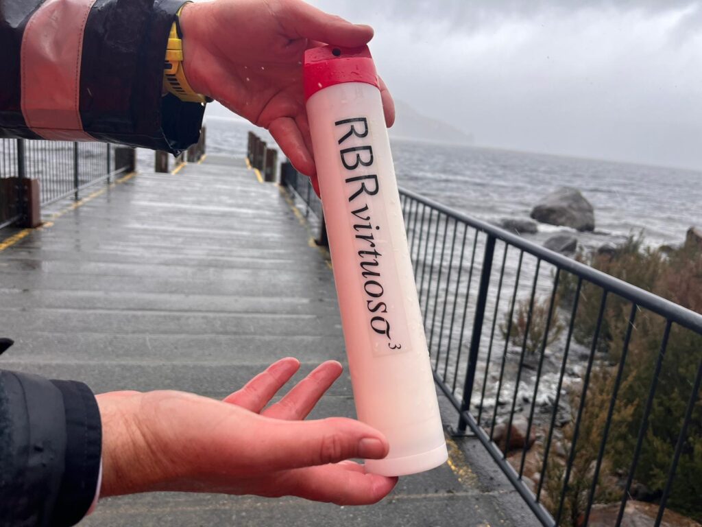
Recognising the importance of capturing these changes, RBR loaned an RBRvirtuoso³ D|tide16 tide gauge to CSIRO to support the hydrographic mapping campaign. Although traditionally used in tidal environments, the instrument’s precision makes it ideally suited for any application requiring high-resolution water-level measurements. In this case, it provided continuous tracking of subtle lake-level variations that would otherwise remain undetected.
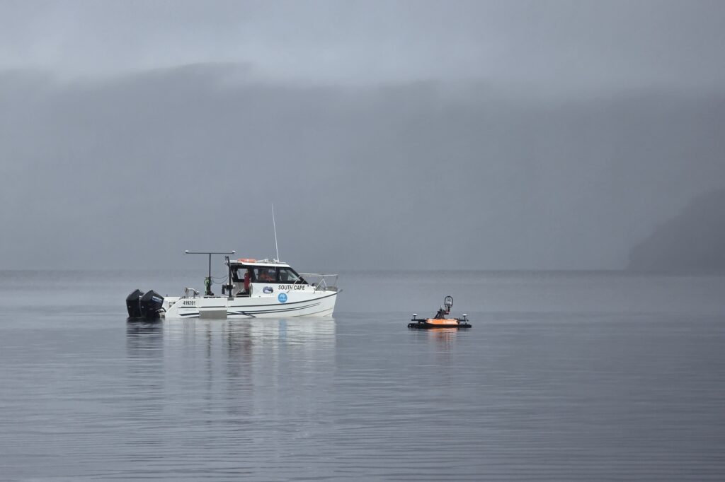
During the two-week survey, carried out using both a crewed hydrographic vessel and an autonomous surface platform, the lake level changed by 35 centimetres. While small in tidal terms, such fluctuations can significantly affect activities in the shallows for boaters, anglers, and bushwalkers. More critically, Lake St Clair feeds the Derwent River, a major water source for Hobart and an essential system for hydroelectric power generation, agriculture, and community use. Even modest variations in lake level can influence downstream flows, storage planning, and environmental management.
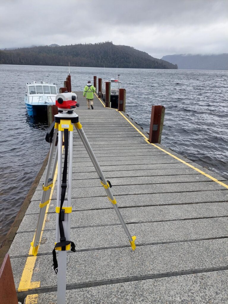
To ensure reliable data, the RBR tide gauge was mounted near the surface and levelled to the local height datum by the CSIRO team. With a sensor accuracy of ±0.05% of full scale — delivering better than ±1 cm precision — the instrument supplied the high-quality measurements needed to support the detailed 3D modelling effort.
RBR congratulates CSIRO on this remarkable and insightful project, particularly the Engineering & Technology Geophysical and Mapping team and the Autonomous Sensors Future Science Platform. Their work not only reveals the hidden depths of Lake St Clair but also enhances our understanding of how Tasmania’s freshwater systems behave, evolve, and sustain the communities and environments that rely on them.
Story by Stef Stimson, RBR