
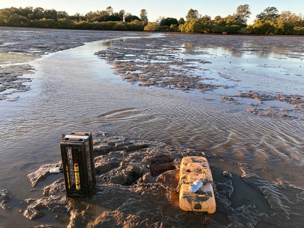
With around 87% of Australia’s population living within 50km of the coast, protecting the coastline against erosion is a priority for many local authorities. The Redlands Coast, on the shores of Moreton Bay in Queensland, Australia, is just one such area. Storm surge, tidal inundation, and everyday wave action have been chipping away at the foreshore at Three Paddocks Park in Birkdale, threatening public land and the shorebird habitat that depends on it. Redland City Council’s answer was not a sea wall but a living shoreline: a combination of hardwood log jams and natural mangrove recruitment designed to absorb wave energy, trap sediment, and repair itself after storms rather than fail catastrophically like conventional hard armouring can.
It is an appealing idea, and a growing one across the world’s coastlines. But nature-based coastal protection has faced a persistent hurdle: limited field evidence of how well it actually performs against the wave energy it is meant to dampen. Councils, engineers, and researchers need real numbers, not just intuition, before they can scale living shorelines up with confidence.
That is where Alluvium Consulting and Griffith University, working alongside Redland City Council, turned to RBR. Three compact RBR pressure loggers were deployed for 25 days at offshore, protected, and unprotected control locations across the site, giving the team high-frequency pressure and wave measurements they could compare directly, location by location.
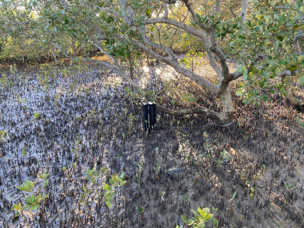
Pressure loggers are a natural fit for this kind of work. Submerged just below the surface or on the seabed, they sense the small fluctuations in water pressure that waves create as they pass overhead, and that signal can be converted into wave height, period, and energy. Because the instruments are compact, self-contained, and sit low in the water column, they are ideal to be deployed in shallow, wave-swept, intertidal ground, exactly the environment a living shoreline occupies and exactly the environment that makes a surface buoy impractical.
That said, deploying in an intertidal zone metres from a popular public park brought its own challenges: exposure at low tide, the risk of damage, and the very real possibility of tampering or theft. The team addressed this by building a robust steel security cage for each logger, with sides permeable enough to leave the hydraulic pressure measurements undisturbed while keeping curious hands and boat traffic away from the instruments.
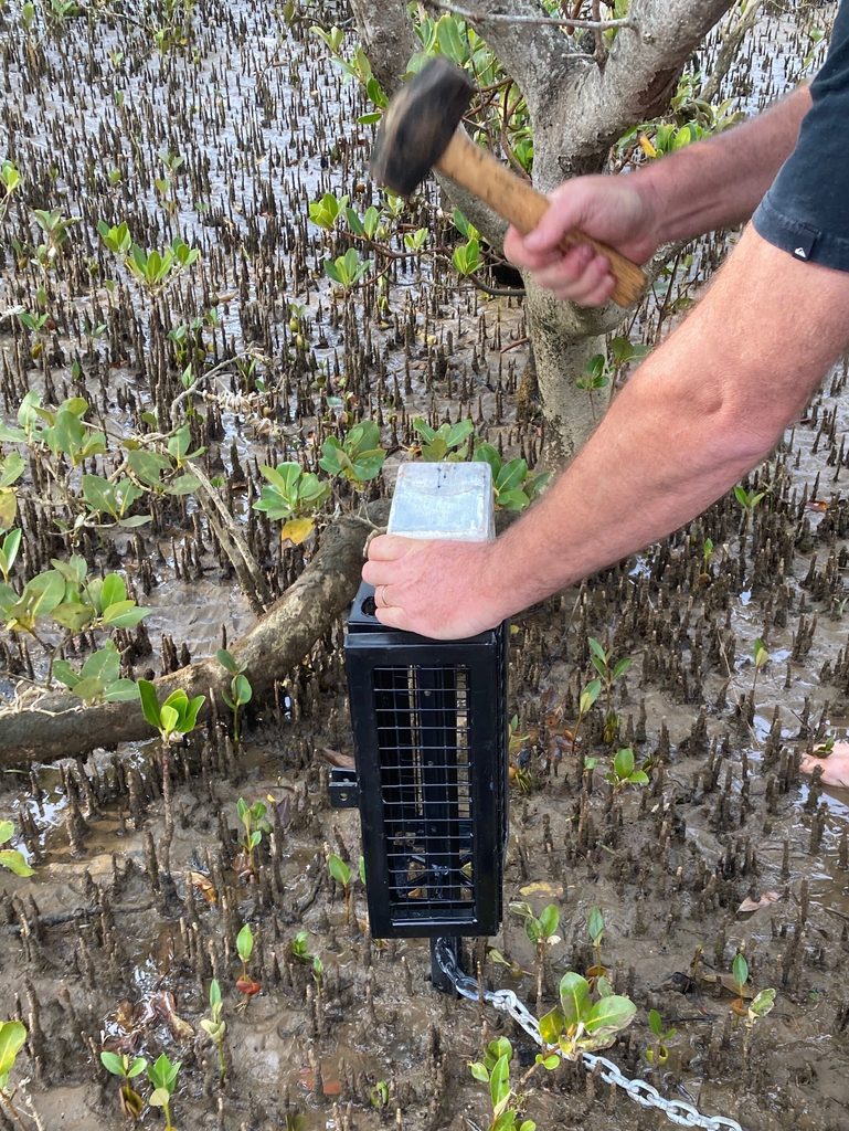
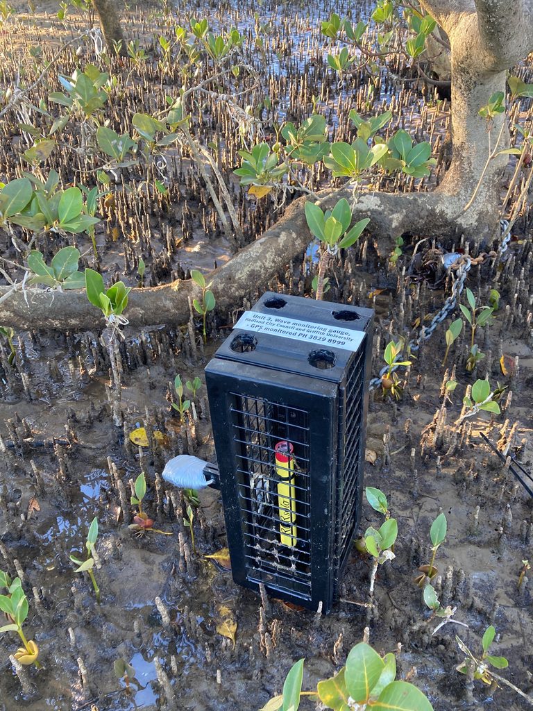
Once the instruments were recovered and their data downloaded, RBR’s Ruskin software processed each logger’s record. Initial analysis of the data indicated that the living shoreline reduced wave height and energy at the protected site significantly compared to the unprotected control, giving the pilot the field evidence it set out to gather.
That data will not sit still. The team now plans to use it to validate numerical coastal models, so the living shoreline’s performance can be tested under far more extreme design conditions, providing greater confidence in how the system may perform during significant coastal storm events.
RBR congratulates the Alluvium Consulting, Griffith University, and Redland City Council team on a project that is helping turn a promising idea into a defensible, data-backed approach to protecting the coast.
Learn more
- Living Shorelines | Redland City Council
- Living barrier to ‘shore up’ coastline at popular Birkdale park – Redlands Coast Today
- RBRsolo4 tide and wave instruments
