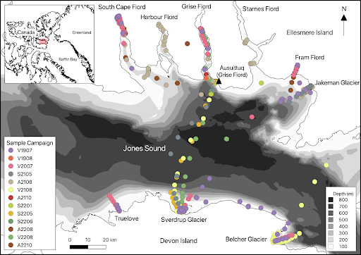
Nestled between Ellesmere Island and Devon Island is Jones Sound, which is located in the rapidly and dramatically changing Canadian Arctic. The coastlines here are characterised by intricate fjords, many of which are highly influenced by tidewater glaciers (i.e. glaciers that end at the head of the fjord which discharge meltwater below the ocean surface). It is a region at particularly high risk of experiencing glacial retreat and melting, and the increased discharge from these tidewater glaciers will inevitably impact the marine environment. Yet, Jones Sound itself has only been sampled a handful of times over the last hundred years and little is known about how it will be impacted by increased glacial meltwater.
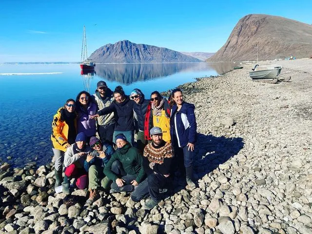
As a result, a multidisciplinary group of scientists has set out to address the unanswered questions in the area. Dr. Maya Bhatia and Dr. Andrew Hamilton, both based out of University of Alberta, are two such scientists focused on better understanding the glacier-ocean interactions here. Their collaborators include Dr. Paul Myers (University of Alberta), Dr. Erin Bertrand (Dalhousie University), Dr. Stephanie Waterman (University of British Columbia), and numerous graduate students and postdoctoral fellows. Since their work started in 2019, they have significantly increased both the scientific monitoring and our understanding of the glacier-ocean system in Jones Sound.
Addressing interdisciplinary research goals
The project has a variety of interdisciplinary research questions – a reflection of the many scientists involved. One of the research goals is to understand biogeochemical nutrient cycling and phytoplankton productivity, function, and nutritional status. Recently they published work based on observations from 2019 to better understand macronutrient concentrations, like nitrogen, in glacierized fjords versus non-glacierized fjords. This work has shown significant nutrient enhancement in fjords with tidewater glaciers (Bhatia et al. 2021; Williams et al. 2021), consistent with previous studies in other Arctic regions, like Svalbard and Greenland.
Another research goal is to better understand the freshwater variability in Jones Sound and the influence of Atlantic waters at depth in the glacial fjords. In the top 100-150m, the waters are cold or fresh; below this depth, the water is warmer and saltier due to an influx of Atlantic water.
“Where [the] seabed is deep enough that Atlantic water can contact tidewater glaciers,” says Hamilton, “[it can] drive enhanced [glacial] melting at the subsurface and further the retreat of some of these glaciers.”
These measurements will allow physical oceanographers to better understand the spatial and temporal variability of the Atlantic water layer in Jones Sound and surrounding fjords, and anticipate any impacts this may have on the glaciers in the region.
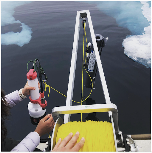
Maximizing the sampling plan with the RBRmaestro³ C.T.D
Given the breadth of research questions being addressed, the RBRmaestro³ C.T.D was the overall preferred instrument for this multi-disciplinary project.
“Getting a multiparameter sensor was key, because we’re not just interested in physical oceanography but also the impacts on the marine ecosystem at the base of the food web,” Bhatia says.
Their operation is additionally quite small, with no big rosette at their disposal. With the RBRmaestro³ and associated Ruskin mobile, they are able to look at their CTD casts in real time and then, after a quick analysis of the CTD results, take bottle samples at precise depths to best address their research questions.
Sampling stations are located all throughout Jones Sound, but largely within the many fjords of southern Ellesmere Island and northeastern Devon Island. The researchers are most interested in the glacial fjords but also sample non-glacierised sites as controls. At each of these sites, they collect CTD casts and single bottle water samples at specific depths to monitor nutrients, microbial community composition, and different types of isotopes. They additionally perform CTD casts on a 10-station transect across Jones Sound from Ellesmere to Devon Island, with five of these stations also being bottle sampled.
Collaborating with the community for year-round sampling
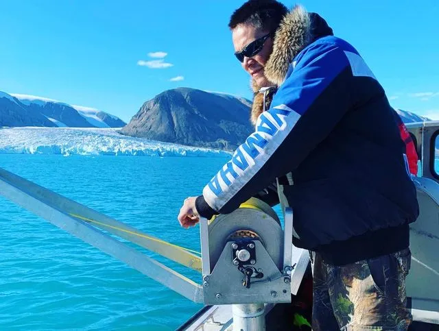
As with much oceanography, particularly in the Arctic, their dataset was originally biased towards summertime values when weather conditions are favourable and travel is easier for southern scientists to make their way North. However, in summer 2021, they moved their research base to Grise Fiord on Ellesmere Island, which led to a unique and ever-evolving partnership with the community. Their current monitoring plan now involves southern scientists and graduate students going to Grise Fiord in spring and summer. The community collaborators, most notably Terry Noah from Ausuittuq Adventures, do additional sampling in fall, winter, and spring, supported by grant funding. The fjord stations near Grise Fiord are sampled seasonally, while the transects across Jones Sound are often only done in summer and spring as they are very labour intensive. This sampling is complemented by observations from a mooring outfitted with a variety of RBR loggers near the terminus of a tidewater glacier and also a monthly sampling site that Noah can easily access year-round.
With their now year-round sampling, they are pushing the limits of their equipment. “That’s exactly the reason why we chose RBR instruments,” Hamilton explains. “They’re one of the few oceanographic quality instruments that are robust enough that they can survive the kind of sampling that we do in -35oC.”
at the University of Alberta
It is in fact not uncommon for Noah to be out sampling in the middle of winter in -37oC blizzard conditions and complete darkness. In these instances, he and his field assistant huddle up in a covered wagon behind his skidoo and sample through a hole drilled in the sea ice. “Terry is a very creative and resourceful guy, so he’s constantly coming up with ways to make winter sampling better and ensure we maintain [the] ability to do sampling in almost any conditions,” Hamilton says. They’re hoping to continue growing this collaboration, aiming to make the year-round sampling more efficient, accessible, and achievable.
Moving forward through ongoing conversations
The community has a lot invested in the results of this project. Grise Fiord is Canada’s northernmost community and is in many ways at the forefront of climate change, experiencing major storm surges and changes in sea-ice cover and weather. The community depends on this rapidly changing marine ecosystem, relying on it as hunting grounds and for harvesting country food.
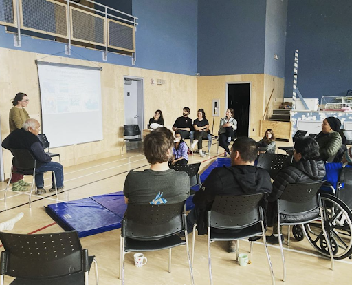
“[We have] formal meetings in the hamlet and a lot of conversations with people just to figure out what they are interested in learning, how they want the results presented to them, what they want to know more about, [and] what direction they want us to change towards,” Bhatia says, “All of that is always in flux. It’s an ongoing conversation.”
In terms of the future science direction of this project, they are hoping to develop numerical models of the region, study the impacts of the glaciers on higher marine trophic levels, and collaborate more with glaciology colleagues to better understand the regional ice masses themselves. So far, this project has undeniably filled a tremendous gap in our knowledge. As it continues to grow and evolve, there is no doubt that it will continue to do so.
Story by Krysten Rutherford
If Grise Fiord sounds familiar, you’ll want to read our story featuring Dr. David Didier (University of Quebec at Rimouski), Characterizing coastline changes and coastal hazards in the Canadian Arctic community of Grise Fiord.