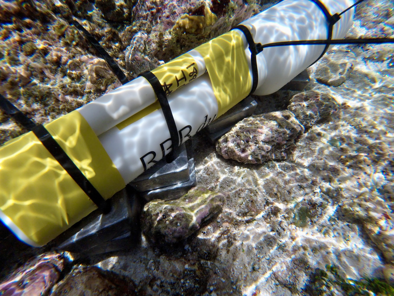
In March 2017, a team from Stanford University deployed five RBRquartz³ Q bottom pressure recorders on the coral reef off the coast of Ofu, a South Pacific island of American Samoa, to resolve centimeter-scale changes in water surface height over the reef. The measurements they collected support the development of a comprehensive understanding of drag over complex terrain.
Quantifying drag over the reef is important for understanding the reef ecosystem: accurately determining flows allows us to quantify reef dynamics, such as the distribution of temperature and momentum, and how larvae move on reefs.
The 2018 study, “Connecting Flow over Complex Terrain to Hydrodynamic Roughness on a Coral Reef”, published in the journal Journal of Physical Oceanography, aimed to measure flow over the coral reef, including the centimeter-scale surface slope caused by friction the reef imposes on the water flowing over it.
To measure flow over the reef, the team led by Justin Rogers, physical oceanographer and engineer in the Environmental Fluid Mechanics Laboratory at Stanford University, deployed an array of velocity, pressure, and temperature loggers, along with five pressure loggers. The RBRquartz³ Q loggers use an integrated Paros Digiquartz® pressure sensor combined with a proprietary RBR datalogger to provide 0.01% accuracy (full scale), 100ppb resolution, and very low drift. RBRquartz³ Q loggers are used in coastal monitoring projects that require high accuracy and high stability.
The BPRs were zip-tied to lead weights, which were buried in sand by the reef. The deployment was designed to characterize the waves and hydrodynamics along the southern coast of Ofu; for that purpose, the RBR pressure loggers sampled continuously for 19 days at 6 Hz.
Rogers explains that to predict flows, the team uses a model called the Stanford Unstructured Nonhydrostatic Terrain-following Adaptive Navier–Stokes Simulator. Their data was used to ground-truth the model, “making sure we are getting the right values for roughness.” To create a detailed map of the reef they partnered with NASA, using drones and fluid lensing techniques for imaging through the ocean’s surface.
“The RBR instruments were critical,” says Rogers, explaining that the difference in surface height they resolved was about one centimeter. “It’s quite small. That aspect was important to give us validation [for our model]. The observations were very high quality.”
The RBRquartz³ Q’s high accuracy and high stability logger is your solution for resolving small changes in long-term water level study projects. Contact us for help or more info.
