Citizen scientists are a boon to oceanography. In a field where measurements are needed across 70% of the Earth’s surface and to depths of hundreds or thousands of meters, citizen scientists, collecting reliable high-quality data – often using RBR instruments – are adding pins to the data map. As their value is becoming more widely recognized, citizen scientists are being enlisted more frequently into scientific work, and improving the quality of the research. Their work is helping researchers tell the story of what’s happening in our ocean.
RBR instruments are easy to use, reliable, accurate and rugged. RBR CTDs include twist activation for start and pause, and Wi-Fi, to allow users to view their data in the field on their tablet or phone using the Ruskin Mobile App, which enables easy download to Dropbox accounts. Most importantly, researchers are confident integrating RBR data collected by citizen scientists into their datasets. Working with communities, researchers and organizations train volunteers to cast instruments and upload their data.
Here are some of our favourite examples of citizen scientists contributing meaningfully to research, and doing it using RBRconcerto and RBRmaestro CTDs:
- WHOI scientists partner with Rhode Island fishermen to understand rapid changes in Gulf Stream-dominated east coast shelf waters
- Beginning in 2014, researchers at Woods Hole Oceanographic Institute (WHOI), USA, partnered with Rhode Island fishing fleets to monitor ocean conditions off the coast of New England. While out on the water, the fishermen collect CTD data that informs both shelf research, complementing the deeper-water Pioneer Array data, and the fishermen’s understanding of changing fish stocks and species movements.
- Citizen scientists cast CTDs as part of an investigation of salmon mortality in British Columbia’s Salish Sea
- From 2015 to 2017, citizen scientists took to their boats and cast CTDs weekly into the Salish Sea, off the west coast of Canada. Their effort provided the oceanographic data that supported an international salmon mortality project. The citizen scientists made measurements at time scales and locations that would have been impossible by conventional oceanographic methods.
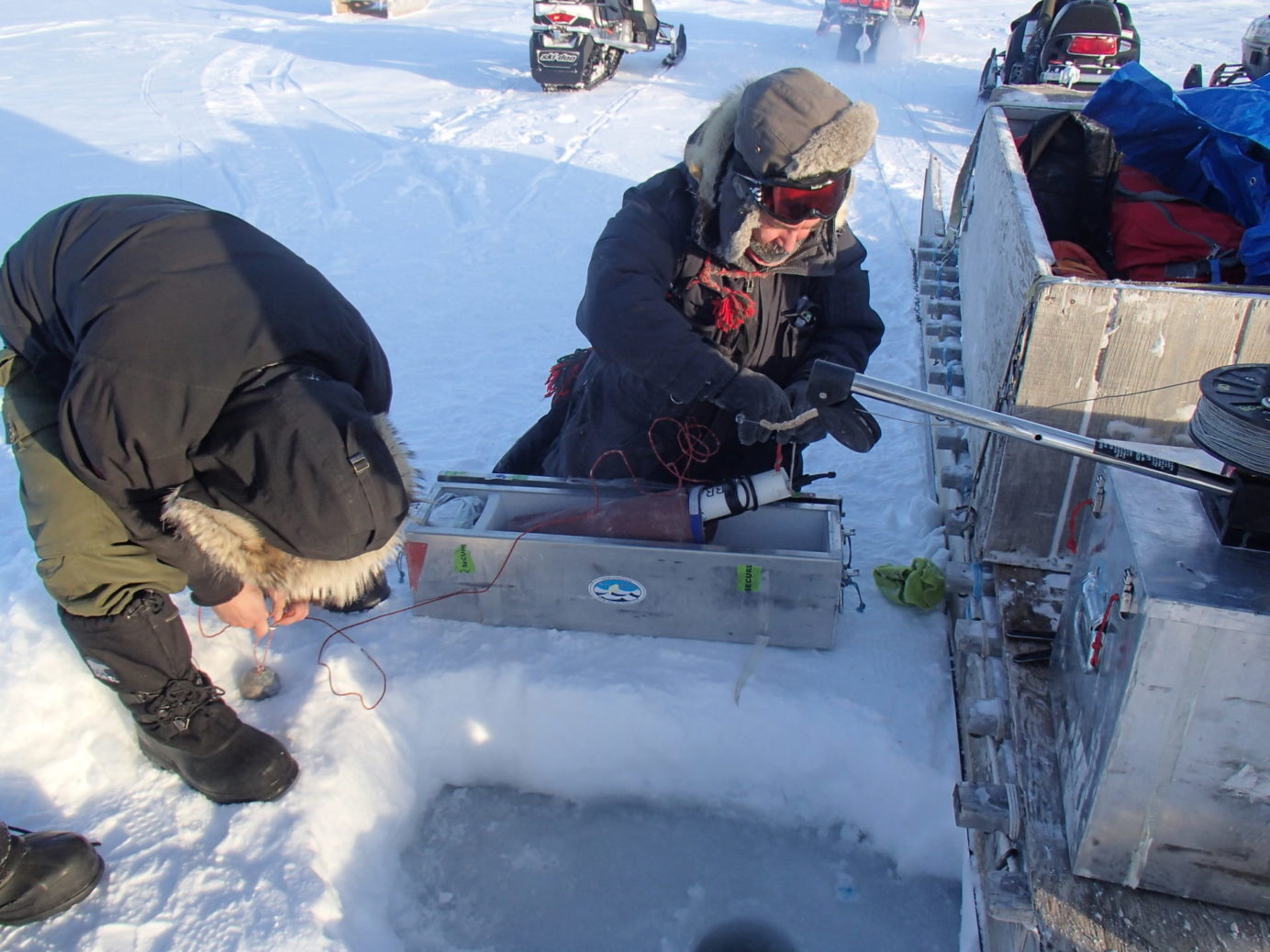
- CROW and Collecting Wintertime Data in the Arctic Ocean
- Starting in 2011, during winter the Canadian Rangers drill holes through the ice and cast CTDs into the Arctic Ocean. Canadian Armed Forces Reservists in remote communities, the Rangers collect data that completes the annual data cycle, increasing our understanding of Arctic Ocean dynamics.
- Enhancing BC Estuaries
- This fall, The Nature Trust of British Columbia, Canada, launched a five-year estuary monitoring program using RBR turbidity sensors and CTDs, in an effort to protect coastal British Columbia (BC) fish stocks. Funded by the BC Salmon Restoration and Innovation Fund, a contribution program funded jointly between Fisheries and Oceans Canada and the Province of BC, The Nature Trust, partners in the West Coast Conservation Land Management Program, and Coastal First Nations will collect data aimed at measuring ecosystem health at 15 sites on Vancouver Island, the central coast and the islands of Haida Gwaii.
RBR CTDs are your reliable solution for citizen, researcher or student -powered science projects. And, their high accuracy data makes them suitable for peer-reviewed publication. Check out our CTDs and full suite of standard loggers, or contact us for help or more info.
Related articles: